 | Online Geographical Information System for the Theban Necropolis |
| Mit Karten und Online-Infos (Kurzbibliografie & Fotos) per GPS durch die Thebanische Gräberwelt. |

|
Das Satellite Survey of Theban Tombs Project und das Santee-Cooper GIS Laboratory of the College of Charleston geben die Neukonfiguration und einen Neustart des " Online Geographical Information System for the Theban Necropolis1 " bekannt. Es handelt sich dabei um ein Online-Geoinformationssystem für die thebanische Nekropole, das laufend ergänzt und erweitert wird. Integriert ist eine umfassende historische und archäologische Datenbank der nicht-königlichen Gräber mit auf GPS basierenden Karten und interaktiven Kartenfunktionen : 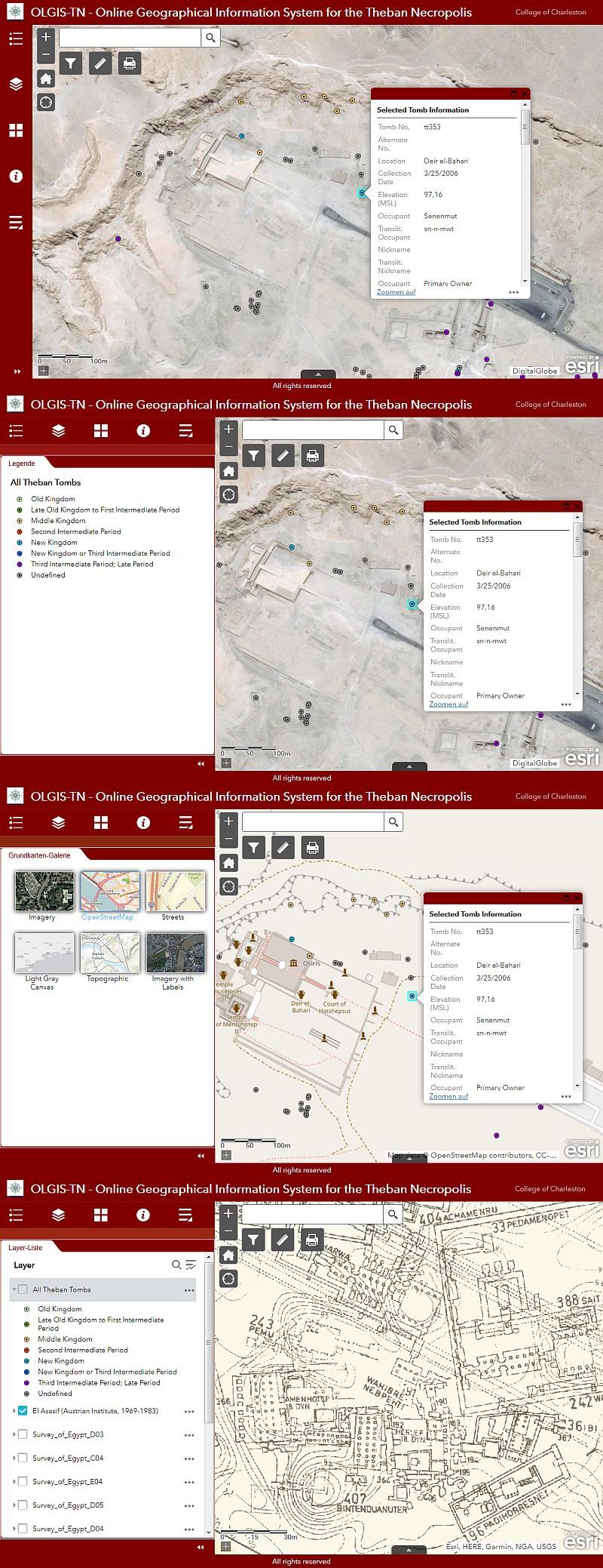 - Vollbild - Datenbank und Karten laufen, sowohl im Feld als auch im Büro, auf jedem Computer, einschließlich Laptop, Tablets, iPads, Notebooks und Smartphones. Die Navigation durch die thebanische Nekropole vor Ort in Echtzeit ist natürlich nur mit GPS-fähigen Geräten möglich. Weitere Informationen : " OLGIS-TN Help and How To2 " (Peter A. Piccione © 2019). | |
1: https://scgis.maps.arcgis.com/apps/webappviewer/index.html?id=cff7333a8b61461eb9d438d91c93ff61 2: https://gis2.cofc.edu/olgistn/Help_Files/index.html | |
https://www.aegyptologie.com/forum/cgi-bin/YaBB/YaBB.pl?action=newsshow&ntag=190916100920 QR-Code einblenden - Info | |